Messages on Anaglyphs group
Post on Anaglyphs group
Viewed
 (445K)
|
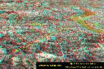
This Google Earth image shows an overview of the hypered 3-D view I just posted. I drew the yellow line to show the straight-line distance from my vantage point to the buildings of downtown Louisville over seven miles away. The terrain is exaggerated by a factor of 3, and, as you can see, these satellite photos which are taken from nearly straight above really make bridges and buildings look flat. Nonetheless, it's fun to have this 'bird's eye view'. Sorry about exceeding the 400K posting limit. This image has much fine detail and I didn't want to reduce it's size any more. Duke |